Shortest walk slot
360 view day
Speedboat, longtail, catamaran
- Viewpoint30 minutes, optional
- Length6 to 6.5 hours
- BoatsSpeedboat, longtail, catamaran
- Pricefrom $37
Map your stop
In brief
The Hong Island viewpoint in Krabi is an optional walk of 30 minutes to 1.5 hours on the day trips that include it, with a 360 degree view from the top.
The viewpoint in brief
Map of 19 stops
Tap a route first, then a pin or stop, for its note and Google Maps.
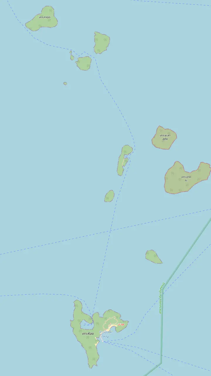
Ko Hong, which the park writes Ko Lao Bi Le and lists as a visitor site, with its ranger station No. 1.
Google MapsKo Lao Riam, another island the park lists beside Ko Hong.
Google MapsKo Lao Lading, an island the park lists, and the second stop on TAT's Hong Islands route.
Google MapsKo Pak Bia, which the park also writes Ko Lao Bulo, and the stop of the sunset dinner day.
Google Maps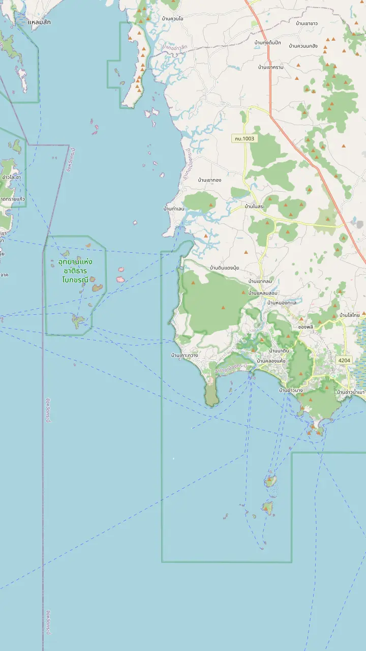
Ao Nang Beach Pier, the beach end of the Ao Nang strip. TAT says boat tours leave from Krabi Town or Ao Nang.
Google MapsNopparat Thara Pier, at the north end of Ao Nang. One speedboat record starts the day here with a safety briefing.
Google MapsKlong Muang Beach, one of the pickup areas named in the site's record.
Google MapsTubkaek Beach, a pickup area in the record of the 360 view day.
Google MapsKo Hong, which the park writes Ko Lao Bi Le and lists as a visitor site, with its ranger station No. 1.
Google MapsKo Lao Lading, an island the park lists, and the second stop on TAT's Hong Islands route.
Google MapsKo Pak Bia, which the park also writes Ko Lao Bulo, and the stop of the sunset dinner day.
Google Maps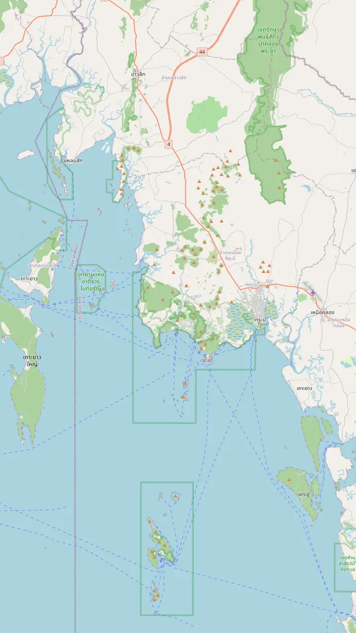
Klong Muang Beach, one of the pickup areas named in the site's record.
Google MapsTubkaek Beach, a pickup area in the record of the 360 view day.
Google MapsNopparat Thara Pier, at the north end of Ao Nang. One speedboat record starts the day here with a safety briefing.
Google MapsAo Nang Beach Pier, the beach end of the Ao Nang strip. TAT says boat tours leave from Krabi Town or Ao Nang.
Google MapsThe floating pier at East Railay, named as a pickup in the record of the 360 view day.
Google MapsAo Nam Mao Pier, where the small group record tells guests staying at Railay to wait.
Google MapsChao Fa Pier in Krabi Town, the town end of the boat trips TAT describes as leaving from Krabi Town or Ao Nang.
Google MapsKo Hong, which the park writes Ko Lao Bi Le and lists as a visitor site, with its ranger station No. 1.
Google MapsMap source: © OpenStreetMap contributors
Where the viewpoint sits among the islands, how many minutes each listing gives the walk, what to wear on your feet, who should skip it and how to photograph it.
Editorial team, hongislandstour.click · Updated November 16, 2026 · ~8 min read
Facts at a glance
Most of the day on the Hong Islands is spent on or beside the water, and the viewpoint is the stop that takes you above it. TAT lists the climb up to the island's panoramic viewpoint among the pieces of the popular boat trip, alongside the beach, the small snorkeling spot and kayaking.2 The records use the same wording as a selling point: the site's own record lists an optional walk to the Hong Island 360 degree viewpoint, and so do several others.
What nobody publishes is a technical description of the path. No official source consulted for this page gives a height, a count of steps or a trail length for the Hong Island viewpoint, so you will not find those figures here either. What you can plan around is time: every record that includes the walk gives it a slot in minutes, and those slots are the best available proxy for how long the climb and the return take at a normal pace.
For that reason the viewpoint works best as a decision rather than a default. On several records it is optional, which means the guide asks on the beach who is going up and who is staying with the bags. If you know you want the Hong Island 360 viewpoint in Krabi on your day, choose a listing that books it into the schedule, and if you would rather swim, choose one where it is an add-on you can skip without feeling you missed something.
Compare the records
| Listing | Viewpoint time | Included or optional | Walk labels |
|---|---|---|---|
| Site speedboat day | 1.5 hours | Optional | Photo stop, walk, hiking |
| 360 view day | 30 minutes | Optional | Photo stop, walk |
| Paradise speedboat day | 1 hour | Listed stop | Photo stop, walk |
| Buffet longtail day | 30 minutes | Optional hike | Hiking, scenic views |
| Small group longtail | 1 hour | Listed stop | Viewpoint stop |
Minutes come from each listing's own record; none of them states a height, a step count or a trail length for the climb.
The viewpoint is on Ko Hong itself, the island the park lists as Ko Lao Bi Le among its visitor sites, and the park keeps ranger station No. 1 there.4,5 The map above pins Ko Hong with its neighbours Ko Lao Riam, Ko Lao Lading and Ko Pak Bia, which the park also writes Ko Lao Bulo.6 The viewpoint itself carries no pin, because no source consulted gives its coordinates, and a guessed pin would be worse than none.
The map also shows why the view is worth the effort. Ko Hong sits at the southern end of the group, with Ko Lao Riam, Ko Lao Lading and Ko Pak Bia stretching away to the north. On TAT's route the boat calls at Ko Hong, Ko Lao Lading and Ko Phak Bia in turn,7 so the islets below you are the ones you reach later by boat. A view from the top works as a preview of the rest of the day, and a way to match names to shapes.
On the boat side, the starting pier matters little for what you see up top but a lot for how long you spend on the way. Records name Nopparat Thara pier, Klong Muang Beach, Tubkaek Beach, Ao Nammao and Ao Nang among the starting and pickup points. The viewpoint stop is far from any of them; the walk begins only after you land on Ko Hong and ends there as well, so a late start eats into beach time before it eats into viewpoint time.
Time for the climb
The site's record lists 1.5 hours and others list 1 hour, shown here as 90 and 60 minutes; the rest give minutes directly.
The records give the walk a slot, and the slots differ. The site's own record lists the viewpoint as an optional stop of 1.5 hours, labeled with a photo stop, a walk and hiking. The Paradise Island speedboat day gives it 1 hour, listed as a photo stop and walk, and then moves to lunch. The 360 view day cuts it to an optional 30 minutes. A longtail day with kayaking lists an optional hike of 30 minutes at Hong Island Beach.
Those numbers are time allowed, not time walking. With a 30-minute slot, a fit walker who skips the photographs can reach the top and come back, but there is little room for a rest. With 1 hour there is time to stand still at the top, and with 1.5 hours the walk can be taken slowly, with a pause on the way up and another at the viewpoint. With children or older relatives, lean toward the longer slots; the short ones suit quick walkers who do not need a rest.
Nothing published counts the stairs to the Hong Island viewpoint. The nearest thing is the hiking record, which says the day includes moderate walking and is unsuitable for pregnant women or anyone with back trouble. That is a sentence about the whole day rather than about the stairs alone, and it is the closest thing to a published effort rating. Treat the climb as a steady, uneven walk in the heat, not as a stroll, and judge it by how you cope with exposed steps in direct sun.
Pick your plan
Say how you feel about a walk in the heat, and the answer points to a day.
If I want the longest, slowest climb
The site speedboat day
The record sets aside 1.5 hours for an optional walk, with hiking and a photo stop.
If I want the viewpoint to be a listed stop
The Paradise speedboat day
It gives the viewpoint 1 hour as part of the program, before lunch.
If I want a quick look and more beach
The 360 view day
Its viewpoint is optional and takes 30 minutes.
If I have a back or heart condition
Skip the climb and the day
Records exclude heart conditions and advise against back problems.
If I want the evening instead
The sunset dinner day
Its stops, between 13:00 and 19:30, include no viewpoint.
Pick your climb
Shortest walk slot
Speedboat, longtail, catamaran
A listed stop
Walk before lunch
Slow climb
Longest slot
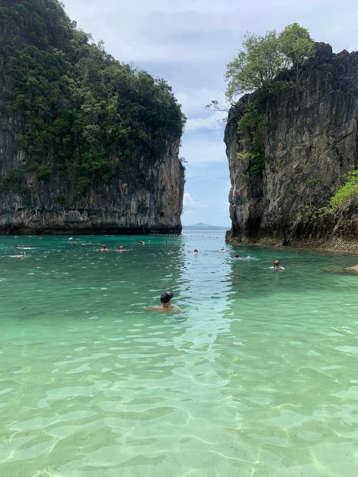
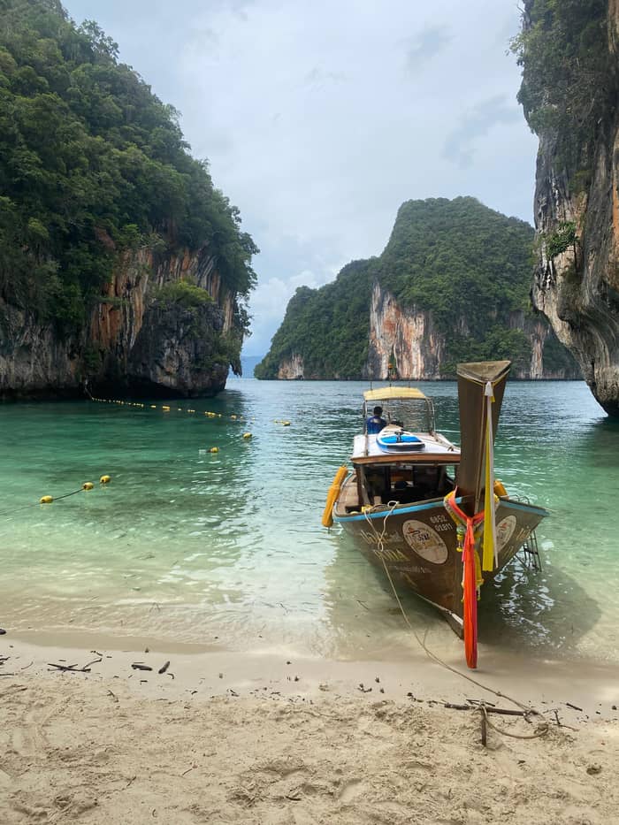
A 360 degree view promises water in every direction. On Hong Island that means the islets of the group, the limestone edges and the colors TAT describes on the island's beach, which are soft, powder-like sand surrounded by indigo sea.11 No record spells out what lies in each direction, so the view depends on the day and the haze. What they do list is the promise, and it is the same promise on many different boats.
Light is the thing you can influence. Low sun brings warm tones on the rock and long shadows on the water, while high sun flattens the shapes and turns the sea a flatter blue. Boat day trips run through the middle of the day, so most arrive under a high sun, and the sunset records are built around the evening instead, running from 13:00 to 19:30 in the case of the dinner day. That sunset record does not list the viewpoint, so choose between golden light and the climb rather than expecting both.
A clear sky is not guaranteed in the rainy season. TAT describes a tropical monsoon climate with a rainy season from late April to December,12 and the park page says the hot summer from mid-January to April is suitable for tourism.13,14 In practice the best conditions for a wide view fall in the drier months, while a rainy-season day can still deliver a good outlook between showers. If the weather turns, the records say the itinerary can change or be rescheduled, so keep the date flexible.
The walk in order
On the beach
Listings make the walk optional, so decide on the sand and carry water in a refillable bottle.3
Setting off
One record advises comfortable sandals or water shoes for island stops.
On the way up
A record describes a moderate amount of walking, so use the slot to rest rather than to race.
At the top
The records promise a 360 degree view and give the stop 30 minutes to 1.5 hours.
Going down
Keep cameras strapped on and the pace even, and meet the guide at the time given.
Start with the feet. The 360 view record advises comfortable sandals or water shoes for island stops, which suits a day that mixes beach landings with the climb. On a path that may be wet from earlier boats, shoes with a grip are better than flip-flops that slide off. If you only own flip-flops, bring a pair of sandals with a heel strap, and keep a dry shirt in a waterproof bag for after the climb.
Heat is the real cost of the walk. The park page calls April the month with the highest average temperature, about 29 degrees Celsius, while the nearest weather station averages a daily high of 34.1 degrees in March, its hottest month.15,16 TAT recommends hats and long-sleeved swimwear to reduce the need for excessive sunscreen,9 and a hat helps on the exposed upper path as well. Carry water in a refillable bottle, since the 155 national parks prohibit single-use plastics and foam containers.3
Some guests should skip the climb or the whole day. Who should skip it? The site's record rules out heart conditions and other serious medical conditions, pregnancy and children under 3 years, another longtail record draws its line at under 2 years, and the hiking record is unsuitable for pregnancy or back problems. If you have a knee or a back that complains on stairs, take the beach time and let the others go up; no record penalizes the guest who stays below.
Video
Ronan Jonet on YouTube · Nothing is fetched until you hit play.
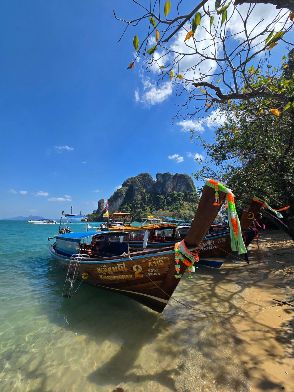
The most popular one takes tourists to Hong Island with a long stop to enjoy its pristine beach, the small snorkelling spot, kayaking, and climb up to its stunning panoramic viewpoint.
Before you climb
For stills, the viewpoint is a place to look outward and also to look down. A wide lens catches the islets, and a phone panorama works if you hold it level and turn slowly. Keep the sun behind or beside you, because shooting into it from the top turns the sea into a white glare. Put a strap on the phone and a cord on the camera: the top is not a place to drop anything, and the way down is a place for both hands.
Drones are the other temptation, and the rules are tighter than most visitors expect. TAT's drone guide makes registration with NBTC and CAAT mandatory for both aircraft and operator, and tells visitors to look up national park requirements first.1,10 The penalty for a breach is set at up to 1 year of imprisonment, up to THB 40,000, or both.17 Hong Island is inside a national park, so the safe answer is not to fly without checking.
If the viewpoint is the main reason you are booking, the listing built around it is the 360 view day, from $37 on its record, which lists an optional 30-minute viewpoint stop, lunch at Ko Pak Bia and Hong Lagoon on the way. The site's own day lists a longer, optional walk of 1.5 hours, and the Paradise Island day gives the viewpoint 1 hour. Read the minutes before the title, and pick the slot that matches how you like to climb.
FAQ
The records give the walk 30 minutes on the 360 view day, 1 hour on the Paradise day and 1.5 hours on the site's own day.
The site's own record and the 360 view record list it as optional, while the Paradise Island record lists it as a stop.
No official source consulted gives a step count, and one record only says the day includes a moderate amount of walking.
One record advises comfortable sandals or water shoes for island stops, and TAT recommends hats against the sun.9
Guests with heart conditions, pregnancy or children under 3 years are excluded by the site's record, and the hiking record cautions people with back problems.
Its optional viewpoint stop is listed at 1.5 hours, against 1 hour on the Paradise day and 30 minutes on the 360 view day.
Sources
Related reading
Heading to the Hong Islands? Ask a real person here.